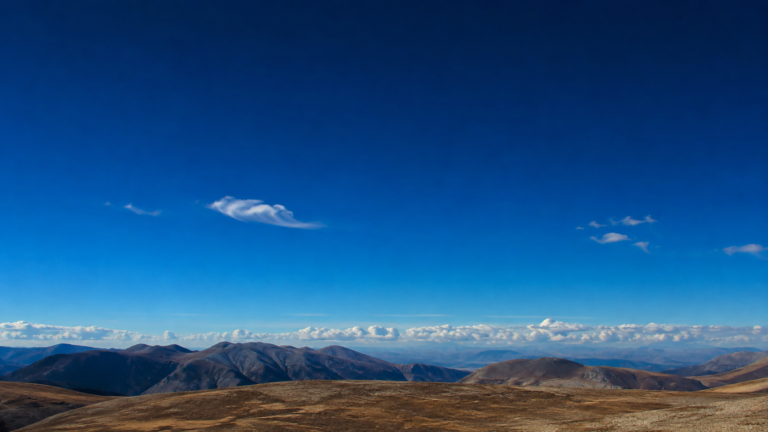

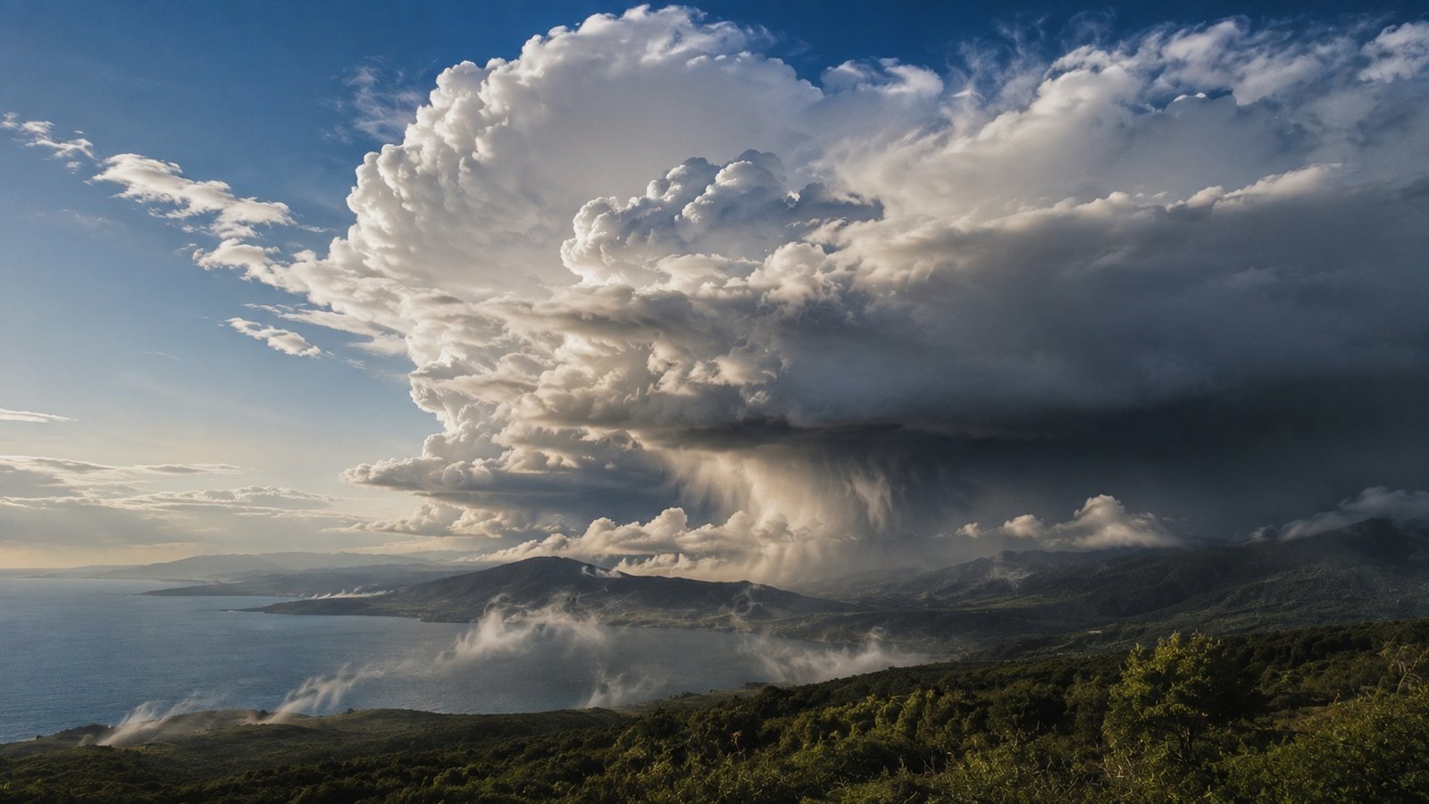
Look up at the sky.
A cloud can appear soft and weightless, almost as if it were floating in place.
But a cloud is not made from smoke or cotton.
It is made mostly of tiny water droplets and, in colder conditions, ice crystals suspended in the atmosphere.
The process begins with water.
Water evaporates from oceans, lakes, rivers, soil, plants, and other surfaces. The resulting water vapor rises into the atmosphere. As the air rises, it usually expands and cools. Eventually, the air can reach a temperature and pressure at which water vapor begins to condense into tiny liquid droplets or deposit as ice crystals.
Those tiny particles form the visible cloud.
Cloud formation therefore depends on several things working together.
- Moisture.
- Rising air.
- Cooling.
- Condensation or ice formation.
- And tiny particles that provide surfaces around which water can gather.
Clouds form when moist air rises, cools, and water vapor condenses into tiny droplets or ice crystals.
Clouds form when moist air rises, cools, and water vapor condenses into tiny droplets or ice crystals.
Where Does the Water in a Cloud Come From?
As moist air rises into lower pressure, it expands and cools, helping create the conditions for cloud formation.
The atmosphere constantly contains water vapor.
The largest source is Earth's surface water.
Sunlight provides energy that causes water to evaporate from oceans, lakes, rivers, and wet ground.
Plants also release water vapor through a process called transpiration.
Together, evaporation and transpiration move enormous amounts of water into the atmosphere.
Water vapor itself is invisible.
You cannot see individual water molecules floating in the air.
A visible cloud appears when enough water changes into tiny liquid droplets or ice crystals that scatter sunlight toward your eyes.
This distinction matters.
The invisible water vapor is not the cloud you see.
The visible cloud consists of condensed or frozen water.
Why Does Air Rise?
Cloud formation often begins with rising air.
Air can rise for several reasons.
The Sun can heat Earth's surface unevenly.
Warm air becomes less dense than the surrounding cooler air and tends to rise.
Mountains can force moving air upward.
Weather fronts can push one air mass over another.
Convergence can force air upward when winds move toward the same region.
Thunderstorms can also produce powerful upward currents.
The mechanism varies.
The result is similar.
Moist air moves upward into regions of lower atmospheric pressure.
Why Does Rising Air Cool?
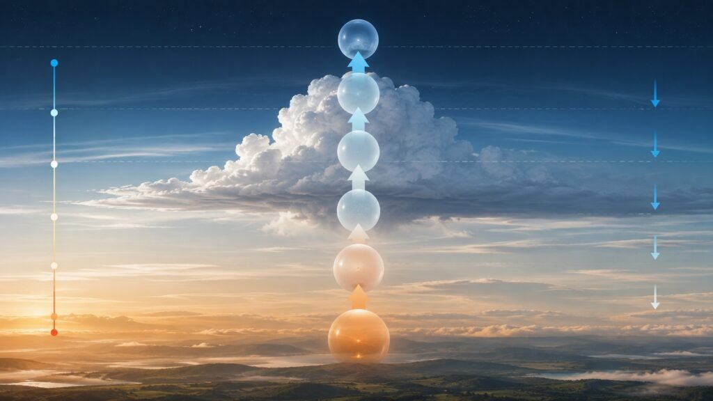
This is one of the most important steps.
As air rises, atmospheric pressure decreases.
The rising air expands.
Expansion requires energy.
The air's internal energy decreases, so its temperature falls.
This is called adiabatic cooling.
You do not need a refrigerator inside the atmosphere.
The pressure change does the work.
A parcel of rising air can therefore cool substantially as it climbs.
If enough water vapor is present, the cooling eventually brings the air toward saturation.
That creates the conditions needed for cloud formation.
As moist air rises into lower pressure, it expands and cools, helping create the conditions for cloud formation.
What Is the Dew Point?
The dew point is the temperature at which air becomes saturated with water vapor at a given pressure.
When moist air cools to its dew point, it can no longer hold all of its water vapor in the gas phase under those conditions.
Some water begins to condense.
This does not mean every molecule instantly becomes liquid.
Instead, water molecules begin joining together on microscopic particles suspended in the air.
The resulting droplets can grow enough to scatter visible light.
A cloud becomes visible.
What Are Cloud Condensation Nuclei?

Tiny atmospheric particles provide surfaces around which water vapor can condense into cloud droplets.
Water vapor generally needs suitable microscopic surfaces around which condensation can occur efficiently.
These particles are called cloud condensation nuclei.
They can include tiny particles of dust, sea salt, smoke, sulfates, and other aerosols.
Water molecules gather around these particles.
The droplets remain extremely small.
A cloud can therefore contain a huge number of tiny droplets while still appearing light and diffuse.
Tiny atmospheric particles provide surfaces around which water vapor can condense into cloud droplets.
Why Does a Cloud Stay in the Sky?
A cloud looks like a solid object.
It is not.
The individual water droplets and ice crystals are extremely small.
Air currents can keep them suspended.
Some droplets fall slowly.
Upward air movement can offset their downward motion.
Clouds are therefore dynamic systems.
Droplets continuously form, grow, evaporate, collide, freeze, and change.
A cloud may look stationary from the ground while its individual particles are constantly changing.
This is one reason clouds can appear to drift, grow, disappear, and reform.
Why Are Clouds White?
Cloud droplets are much larger than individual gas molecules.
They scatter visible wavelengths relatively broadly.
Because the different colors of visible light remain mixed together, the scattered light appears white.
The same basic scattering behavior helps explain why clouds can look bright against a blue sky.
The appearance changes when a cloud becomes thick enough to block more sunlight.
Then less light reaches your eyes from the lower parts of the cloud.
The cloud can appear gray or dark.
Why Do Some Clouds Look Gray?
A thick cloud can contain a large amount of water and many layers of droplets.
Light entering the cloud is scattered repeatedly.
Less light may emerge from the lower surface toward an observer on the ground.
The cloud therefore appears darker.
A gray cloud is not necessarily made from gray water.
The color comes from how much light reaches your eyes after passing through or being scattered within the cloud.
Large storm clouds can become especially dark because they can be deep and dense.
How Does a Cloud Become a Rain Cloud?
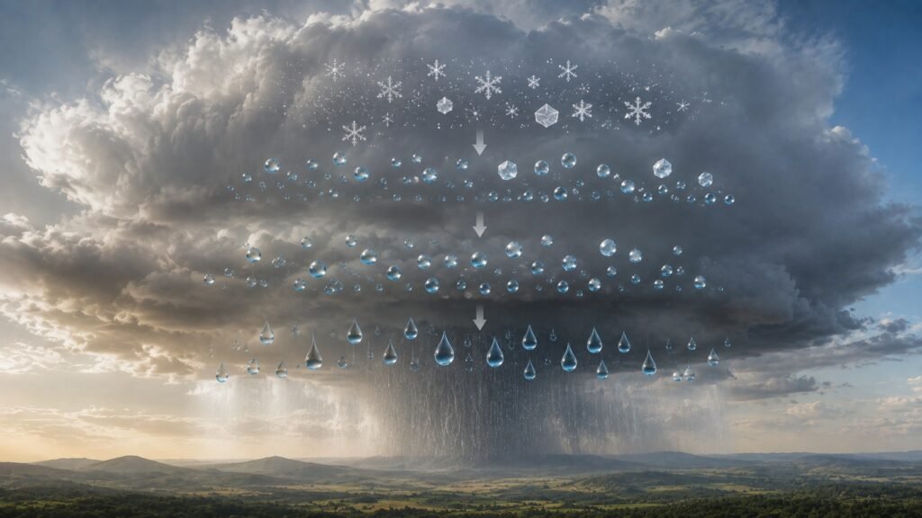
Rain develops when cloud water or ice particles grow large enough to fall from the cloud.
A cloud does not automatically produce rain.
Its droplets must grow substantially before they can fall as precipitation.
Cloud droplets begin extremely small.
Gravity pulls them downward.
But their small size means air resistance keeps them suspended easily.
For rain to develop, droplets or ice particles must grow.
Several processes can accomplish this.
In warm clouds, droplets can collide and merge.
In colder clouds, ice crystals can grow at the expense of nearby supercooled water droplets.
Eventually, particles become large enough for gravity to overcome the upward support provided by air movements.
They begin falling.
Rain develops when cloud water or ice particles grow large enough to fall from the cloud.
How Does Collision and Coalescence Make Rain?
In warm clouds, droplets have different sizes.
Larger droplets fall faster than smaller droplets.
As a larger droplet moves through the cloud, it can collide with smaller droplets.
If the droplets merge, the larger droplet becomes even larger.
This process is called collision and coalescence.
Thousands or millions of these microscopic interactions can eventually produce raindrops large enough to fall toward the ground.
The process is especially important in warm clouds.
How Do Ice Crystals Help Produce Rain?
Many clouds contain temperatures below freezing.
Yet they can still contain liquid droplets.
These are called supercooled droplets.
In such clouds, ice crystals can grow because water vapor can deposit onto ice more readily than it remains as vapor near liquid droplets under suitable conditions.
As ice crystals grow, they can also collide with other particles.
Eventually, they may become large enough to fall.
If they pass through warmer air below the cloud, they can melt and reach the ground as rain.
This is one important pathway for precipitation formation.
Why Do Clouds Form at Different Heights?
Different cloud types form under different atmospheric conditions.
Some develop near the surface.
Others form high in the troposphere.
Temperature, humidity, atmospheric stability, and the mechanism lifting the air all influence cloud altitude.
High clouds often contain ice crystals because temperatures are very low.
Lower clouds are more likely to contain liquid water droplets, although mixed-phase clouds can contain both liquid and ice.
Cloud height therefore provides clues about atmospheric conditions.
Why Do Clouds Look So Different?
Clouds come in many shapes and sizes.
Some are flat and layered.
Some are tall and towering.
Some appear as thin wisps.
The shape depends partly on how air moves through the atmosphere.
Stable air tends to favor layered clouds.
Strong upward convection can produce tall clouds.
A rapidly rising parcel of warm, moist air can create a towering cumulus cloud.
If the upward motion becomes strong enough, the cloud can grow into a thunderstorm.
Cloud shape is therefore a visible record of atmospheric motion.
How Do Thunderstorm Clouds Form?
Thunderstorms require strong upward motion and sufficient moisture.
Warm, moist air rises.
As it rises, it cools and condenses.
Condensation releases latent heat.
That released energy can make the rising air warmer than its surroundings, helping it continue upward.
The cloud can grow vertically.
If the atmosphere supports continued upward development, a large cumulonimbus cloud can form.
These clouds can reach high into the troposphere and produce heavy rain, lightning, strong winds, hail, and sometimes tornadoes.
The same basic cloud-forming process is involved.
The difference is the scale and strength of the atmospheric circulation.
Why Do Clouds Sometimes Disappear?
A cloud can disappear when its droplets or ice crystals evaporate or sublimate back into water vapor.
This can happen when the surrounding air becomes warmer or drier.
A descending parcel of air can also warm as pressure increases.
If the air becomes unsaturated, cloud droplets can evaporate.
This is why a cloud can seem to vanish as it moves into a different part of the atmosphere.
The water has not necessarily disappeared from the environment.
It may simply have returned to invisible water vapor.
Can Clouds Form Near the Ground?
Yes.
A cloud that forms at ground level is called fog.
The physical process is closely related.
Moist air near the surface cools until it reaches saturation.
Water condenses into tiny droplets.
Those droplets remain suspended close to the ground.
The result is fog.
Fog is therefore essentially a cloud at or near Earth's surface.
Why Do Mountains Create Clouds?
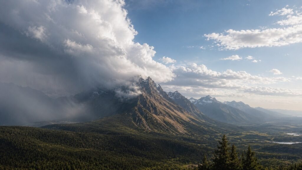
Mountains can force moist air upward, allowing it to cool and form clouds.
Mountains can force moist air upward.
As the air rises along the mountain slope, atmospheric pressure decreases.
The air expands and cools.
If it reaches saturation, clouds can form.
This process is called orographic lifting.
The windward side of a mountain can therefore receive substantial cloud cover and precipitation.
After crossing the mountain, descending air can warm and become drier.
This can contribute to a rain shadow on the leeward side.
A mountain can therefore influence both cloud formation and regional climate.
Mountains can force moist air upward, allowing it to cool and form clouds.
Why Does Humidity Matter?
Cloud formation requires sufficient moisture.
Air with very little water vapor can rise and cool without producing much cloud.
Moist air has a greater supply of water available for condensation.
This is why warm, humid conditions can support strong cloud development when rising motion is present.
Humidity alone does not guarantee clouds.
The air must also cool sufficiently or otherwise reach saturation.
Cloud formation is therefore a combination of moisture and atmospheric conditions.
What Makes a Cloud Grow?
Clouds can grow when rising air continues supplying moisture.
As more air rises and cools, additional water vapor condenses.
Droplets and ice crystals can increase in number and size.
Strong upward motion can transport moisture higher into the atmosphere.
If the surrounding atmosphere remains favorable, the cloud can become larger and taller.
When the supply of rising moist air weakens, cloud growth can slow or stop.
The balance between rising motion, condensation, evaporation, and precipitation controls the cloud’s evolution.
The Simple Science Behind Cloud Formation
The process can be reduced to a sequence.
Water evaporates from Earth’s surface.
Water vapor enters the atmosphere.
Moist air rises.
The rising air expands and cools.
The air approaches saturation.
Water vapor condenses around microscopic particles.
Tiny droplets or ice crystals form.
Millions of these particles create a visible cloud.
Some clouds continue developing.
Their droplets or ice particles grow.
Eventually, precipitation can form.
The cloud may then rain, evaporate, or change into another cloud structure.
A cloud is therefore part of the water cycle, not a separate object floating above it.
Why Are Clouds Important?
Clouds are central to Earth’s climate and water cycle.
They transport water through the atmosphere.
They produce precipitation.
They reflect some incoming sunlight back toward space.
They also absorb and emit infrared radiation.
The overall effect of clouds on Earth’s energy balance is complex because different cloud types behave differently.
Low clouds often have a strong cooling influence because they reflect substantial sunlight.
High thin clouds can have a warming influence because they allow much sunlight through while still interacting with outgoing infrared radiation.
Clouds therefore influence both weather and climate.
What Can You Learn From Clouds?
Clouds provide visible information about the atmosphere.
Flat layered clouds can indicate stable air.
Rapidly growing towers can indicate strong convection.
High thin clouds can indicate ice-rich upper-level conditions.
Dark, vertically developed clouds can signal heavy precipitation or thunderstorms.
Meteorologists use cloud observations alongside satellites, radar, weather stations, aircraft measurements, and atmospheric models.
A cloud may look simple from the ground.
To a meteorologist, its structure can reveal what the atmosphere is doing.
The Strange Lesson of Clouds
A cloud looks like a solid object.
It is mostly empty space filled with microscopic droplets and ice crystals.
Those particles are constantly moving.
They form.
They grow.
They collide.
They evaporate.
They freeze.
They fall.
They return to vapor.
The cloud exists because atmospheric conditions continually support those particles.
Change the temperature.
Change the humidity.
Change the air movement.
The cloud can change with them.
That is why clouds can appear, grow, merge, rain, and disappear within hours.
The cloud is not the water itself.
It is a temporary visible stage in the movement of water through Earth’s atmosphere.
Key Takeaways
- Clouds consist mainly of tiny water droplets, ice crystals, or both.
- Water vapor enters the atmosphere through evaporation and transpiration.
- Rising air expands and cools.
- Cooling can bring moist air to saturation.
- Water vapor condenses around microscopic particles called cloud condensation nuclei.
- Clouds remain suspended because their tiny particles fall slowly and atmospheric air currents support them.
- Cloud droplets can grow through collision and coalescence.
- Ice crystals can also contribute to precipitation formation.
- Fog is essentially a cloud at or near Earth’s surface.
- Clouds are essential parts of Earth’s weather, water cycle, and energy balance.
Conclusion
Clouds form through a chain of physical processes.
Water enters the atmosphere as vapor.
Moist air rises.
The air expands and cools.
Eventually, the air becomes saturated.
Water vapor condenses around microscopic particles.
Tiny droplets and ice crystals appear.
Millions of these particles create the cloud you see.
Some clouds remain small.
Others grow into enormous storm systems.
Some produce rain.
Others evaporate before precipitation reaches the ground.
Every cloud is therefore temporary.
It is a visible stage in the continuous movement of water through Earth’s atmosphere.
The next time you look at a cloud, you are seeing atmospheric physics in action.
Explore more evidence-based explanations of science, Earth, and the natural world in CAVELYRA’s Science Explained collection.