
You open a map and a blue dot appears.
You start moving, and the dot moves with you.
The experience feels effortless. Yet your phone is solving a surprisingly complex positioning problem.
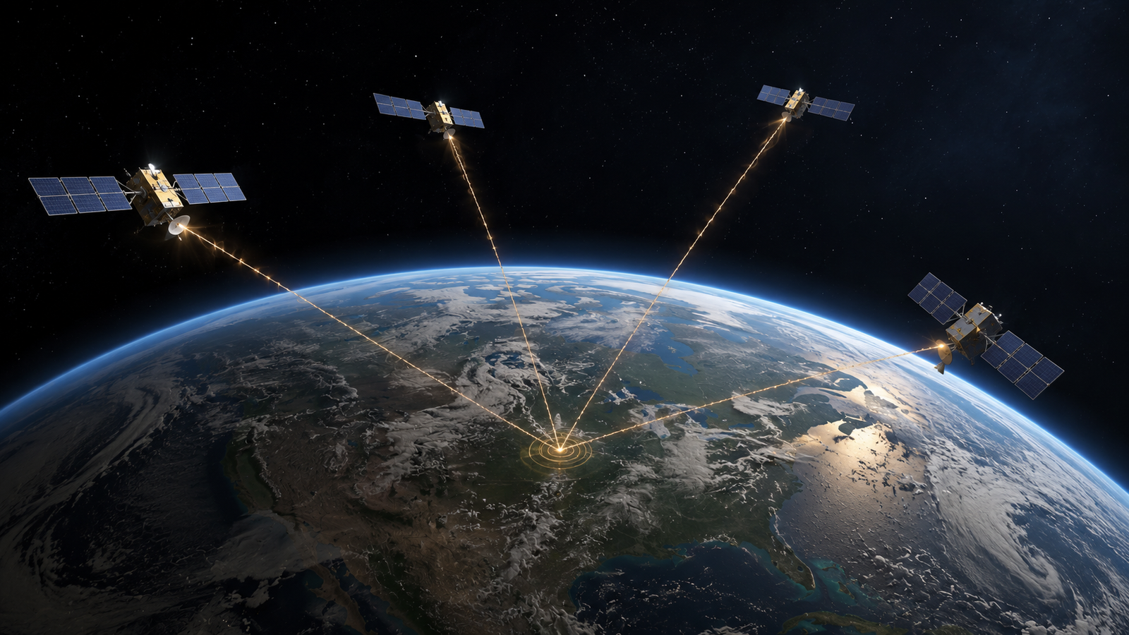
GPS does not simply look down from space and identify you. Satellites broadcast precisely timed radio signals toward Earth. Your receiver measures those signals, compares their timing, estimates distances, and uses multiple measurements to calculate its position.
That calculation depends on geometry, extremely precise clocks, atmospheric corrections, and even Einstein’s theory of relativity.
What Is GPS?
GPS, or the Global Positioning System, is a satellite-based positioning system. A network of satellites orbiting Earth continuously broadcasts signals toward the planet. Those signals contain information about the satellite and precise timing information.
A GPS receiver on Earth detects these signals and calculates its own position from them.
This distinction matters. The satellites do not need to receive your phone’s location to determine where you are. Your receiver listens to the satellites and performs the positioning calculation.
GPS is fundamentally a positioning system based on signal timing.
The blue dot is not a picture of where you are. It is the result of a calculation performed from satellite signals.
How Does a Satellite Signal Reveal Distance?
Radio signals travel at a known speed, close to the speed of light. That makes travel time useful for estimating distance.
If your phone knows when a signal was transmitted and when it arrived, the elapsed time provides information about how far the signal traveled.
One satellite, however, cannot tell your phone exactly where you are. Knowing your distance from one satellite means you could be anywhere on a large sphere surrounding that satellite.
Your receiver needs additional measurements.
Why Does GPS Need Multiple Satellites?
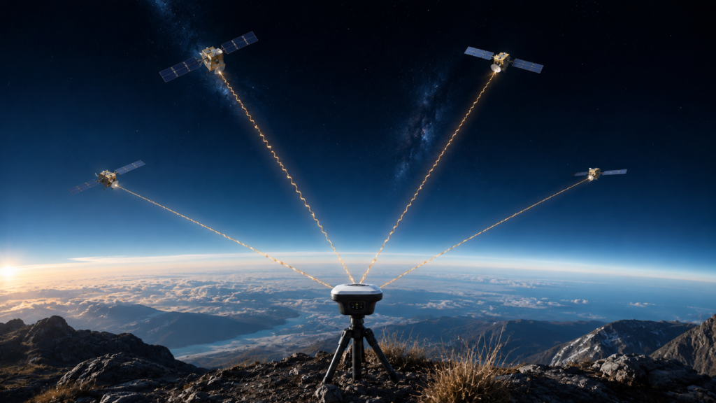
A second satellite provides another distance measurement. A third adds another geometric constraint. With enough measurements, the possible locations become increasingly restricted.
But GPS has another problem to solve. Your phone’s clock is not synchronized with the highly precise clocks aboard the satellites.
The receiver therefore has to determine both its position and its own clock error.
A basic three-dimensional GPS solution commonly requires four satellite measurements for this reason. Additional satellites provide more measurements and can improve the overall solution.
GPS Uses Trilateration, Not Triangulation
GPS is often described as triangulation. Technically, that is misleading.
Triangulation determines position using angles. Trilateration determines position using distances.
GPS estimates distances from satellites using signal travel times. It then uses those distances to calculate position.
Why Does GPS Need Such Precise Timing?
Radio signals travel extremely fast. They move at nearly 300,000 kilometers per second in vacuum.
That speed creates a problem. A very small timing error can become a significant distance error. Light travels roughly 300 meters in one microsecond, so an error of only one millionth of a second can correspond to hundreds of meters.
GPS therefore requires timing precision far beyond what an ordinary consumer clock can provide.
Why Do GPS Satellites Need Atomic Clocks?
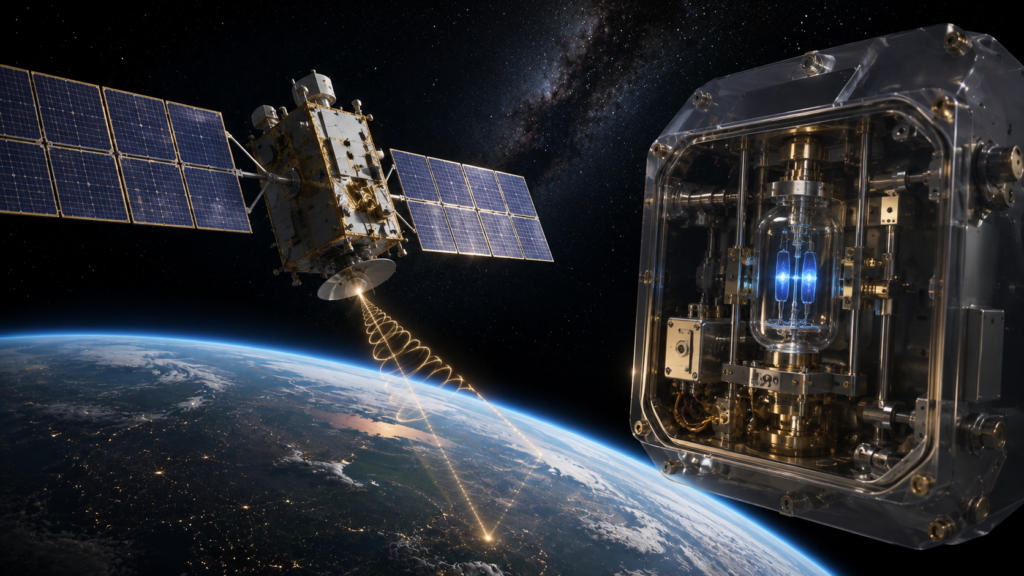
GPS satellites carry highly precise atomic clocks. Atomic clocks use predictable transitions in atoms to maintain extremely precise time.
The satellites use these clocks to timestamp their signals. Your receiver compares timing information from different satellites and uses those measurements to estimate how far each signal traveled.
The satellites therefore provide more than radio signals. They provide a highly precise time reference.
Why Doesn’t Your Phone Need an Atomic Clock?
Your smartphone does not contain an atomic clock equivalent to the clocks aboard GPS satellites.
Instead, the receiver treats its own clock error as another unknown. With enough satellite measurements, it can solve for both its position and its clock offset.
This is why the fourth satellite matters in a basic three-dimensional solution.
What Is a Pseudorange?
Your phone does not directly measure the physical distance to a satellite. It measures the arrival time of the satellite signal.
From that timing, it estimates a quantity called pseudorange. The term matters because your receiver’s clock is not perfectly synchronized with the satellite clocks, so the measured range contains clock-related error.
The receiver solves for that clock offset while calculating its position. With more satellites, it has more measurements that can help identify the position that best fits the available data.
Where Are GPS Satellites?
GPS satellites orbit roughly 20,200 kilometers above Earth’s surface. They are constantly moving.
Your receiver therefore needs information about where the satellites were when their signals were transmitted. The signals contain information that helps the receiver determine the satellites’ positions.
Knowing signal travel time alone is not enough. The receiver must also know where the transmitting satellites were.
Why Does Satellite Geometry Matter?
The number of satellites matters, but their positions in the sky matter too.
If visible satellites are clustered in one small region, their measurements provide weaker geometric constraints. If satellites are spread across different parts of the sky, the measurements can provide stronger constraints.
This is why GPS accuracy depends on satellite availability and geometry.
A receiver with several well-positioned satellites can sometimes produce a stronger solution than one with more satellites in poor geometry.
Why Is GPS Sometimes Less Accurate?
GPS signals travel through Earth’s atmosphere before reaching your phone. The ionosphere can affect radio signal propagation, while the troposphere can introduce propagation effects related to atmospheric conditions and water vapor.
Receivers and correction systems account for these effects to improve accuracy.
The atmosphere therefore introduces another source of uncertainty.
Why Does GPS Struggle Indoors and in Cities?

GPS signals are relatively weak by the time they reach Earth’s surface. Buildings can block them, and they can also reflect them.
A signal may reach your phone directly while another version of the same signal reaches it after bouncing off a building. This creates a multipath effect.
Dense cities combine both problems. Tall buildings can reduce the number of satellites your phone can see, while reflected signals can introduce additional errors.
That is why the blue dot may sometimes jump, appear on the wrong side of a road, or become less precise between tall buildings.
Does Your Phone Use Only GPS?
Usually, no.
Modern smartphones can combine satellite positioning with other technologies, including Wi-Fi positioning, cellular network information, Bluetooth, accelerometers, gyroscopes, maps, and other location data.
This combination can improve the speed and usefulness of the location estimate. If satellite signals become weak, other positioning technologies can still contribute information.
The blue dot you see may therefore represent a combination of location technologies rather than GPS alone.
What Is Assisted GPS?
A smartphone can obtain useful satellite information through an internet or cellular connection. This can help the receiver acquire satellites more quickly.
Instead of beginning with little information, the device can receive information about satellite positions and timing. This can reduce the time needed to establish a location.
This approach is commonly called assisted GPS.
Is GPS the Only Satellite Navigation System?
No.
GPS is one global satellite navigation system. Other systems include GLONASS, Galileo, and BeiDou.
Receivers can use signals from multiple systems. This is called multi-constellation positioning.
Using multiple constellations can increase the number of available satellites and improve positioning availability and geometry.
How Accurate Is GPS?
GPS accuracy depends on conditions. Under good conditions, consumer receivers can often determine position within a few meters.
Accuracy varies with satellite geometry, atmospheric conditions, receiver quality, signal obstruction, multipath effects, and correction techniques.
Specialized systems can achieve much greater precision. Surveying equipment can reach centimeter-level positioning when advanced correction methods are used.
The same positioning technology can therefore support ordinary navigation and high-precision professional applications.
How Does GPS Help in Everyday Life?
GPS connects physical movement with digital information.
Farmers can use satellite positioning to guide machinery and map fields. Transportation systems use satellite positioning for navigation. Ride-sharing applications combine location with maps, routing, communication networks, and traffic information.
Delivery systems use positioning to connect physical movement with digital maps. Fitness applications can combine positioning with motion sensors to record routes and movement.
GPS provides an important positioning layer. Other software, sensors, maps, and communication networks turn that position into useful services.
Why Does GPS Need Einstein’s Relativity?
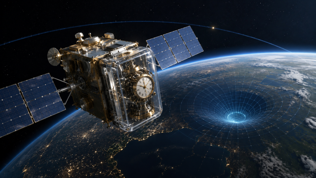
This may be the most surprising part. GPS satellites move rapidly relative to observers on Earth. They also orbit much farther from Earth’s center, where the gravitational field is weaker. Both effects influence clock rates.
For GPS satellites, the combined difference is about 38 microseconds per day.
That sounds tiny, but it matters because GPS depends on extremely precise timing. Small timing differences can become significant distance errors.
Without relativistic corrections, GPS positioning would quickly become inaccurate by kilometers per day. Einstein’s theories are therefore part of the technology behind the blue dot on your phone.
Relativity may seem abstract, but GPS depends on it every time your phone calculates a position.
How Does Your Phone Calculate the Final Position?
Your receiver receives signals from several satellites. It estimates the distance associated with each signal, knows where the satellites were when they transmitted, and accounts for receiver clock error.
It also considers satellite geometry, signal conditions, and atmospheric effects. Then it solves for the position that best fits the available measurements.
The map takes that calculated position and turns it into something recognizable, such as a road, building, or city.
How Does GPS Represent Earth’s Shape?
GPS does not treat Earth as a flat surface. Position calculations use a mathematical model of Earth’s shape.
Earth is approximately an oblate spheroid, slightly flattened at the poles and wider around the equator.
GPS commonly uses the WGS84 reference system to represent positions consistently around the world.
Can GPS Determine Elevation?
Yes, but vertical accuracy is often worse than horizontal accuracy. Satellite geometry and atmospheric effects contribute to this difference.
A smartphone may also combine GPS with a barometer. A barometer measures atmospheric pressure, which changes with altitude.
Combining several measurements can improve the elevation estimate.
How Do Motion Sensors Help?
Your phone contains an accelerometer and gyroscope. These sensors can help estimate movement when satellite signals temporarily disappear.
This is called inertial sensing.
For example, GPS signals may become weak or unavailable inside a tunnel. Your phone can continue estimating movement using its motion sensors for a while.
But inertial systems accumulate error over time. When satellite signals return, they can help correct that drift.
Combining multiple imperfect measurements is called sensor fusion.
Why Can the Blue Dot Be Wrong?
The blue dot represents an estimate.
That estimate depends on measurements that contain uncertainty. Buildings can reflect signals, trees can obstruct them, atmospheric conditions can introduce errors, and satellite geometry changes.
Your device may also combine several positioning technologies.
You may therefore see the location jump, appear on the wrong side of a road, or become less accurate inside a building.
This does not necessarily mean that GPS has failed. The receiver is working with imperfect measurements.
Related Reading
Key Takeaways
- GPS determines your position from precisely timed signals transmitted by satellites.
- Signal travel time provides distance information, while multiple satellite measurements create the geometry needed to calculate position.
- GPS primarily uses trilateration and also solves for the receiver’s clock error.
- Atomic clocks provide the precise timing that makes satellite positioning possible.
- Satellite geometry, atmospheric conditions, signal blockage, and multipath can affect accuracy.
- Modern smartphones can combine satellite positioning with other location technologies.
- Relativistic corrections are essential because tiny timing differences can become significant positioning errors.
- The blue dot on your phone is an estimated position produced by a complex calculation.
Conclusion
The blue dot on your phone looks simple.
Behind it are satellites orbiting Earth, atomic clocks maintaining precise time, radio signals traveling thousands of kilometers, and algorithms solving a positioning problem.
Your phone measures when satellite signals arrive. It turns timing into distance, combines multiple measurements, accounts for clock error and other uncertainties, and calculates a position.
A map then turns those coordinates into something you can understand.
And built into the system is Einstein’s relativity, because even tiny differences in clock rates matter when position depends on extremely precise timing.
GPS does not need to see you.
It works through measurement.
Time becomes distance.
Distance becomes geometry.
Geometry becomes position.
Position becomes navigation.
That is how GPS finds you.
Explore more evidence-based explanations of technology, physics, and everyday science in CAVELYRA’s Science Explained collection.